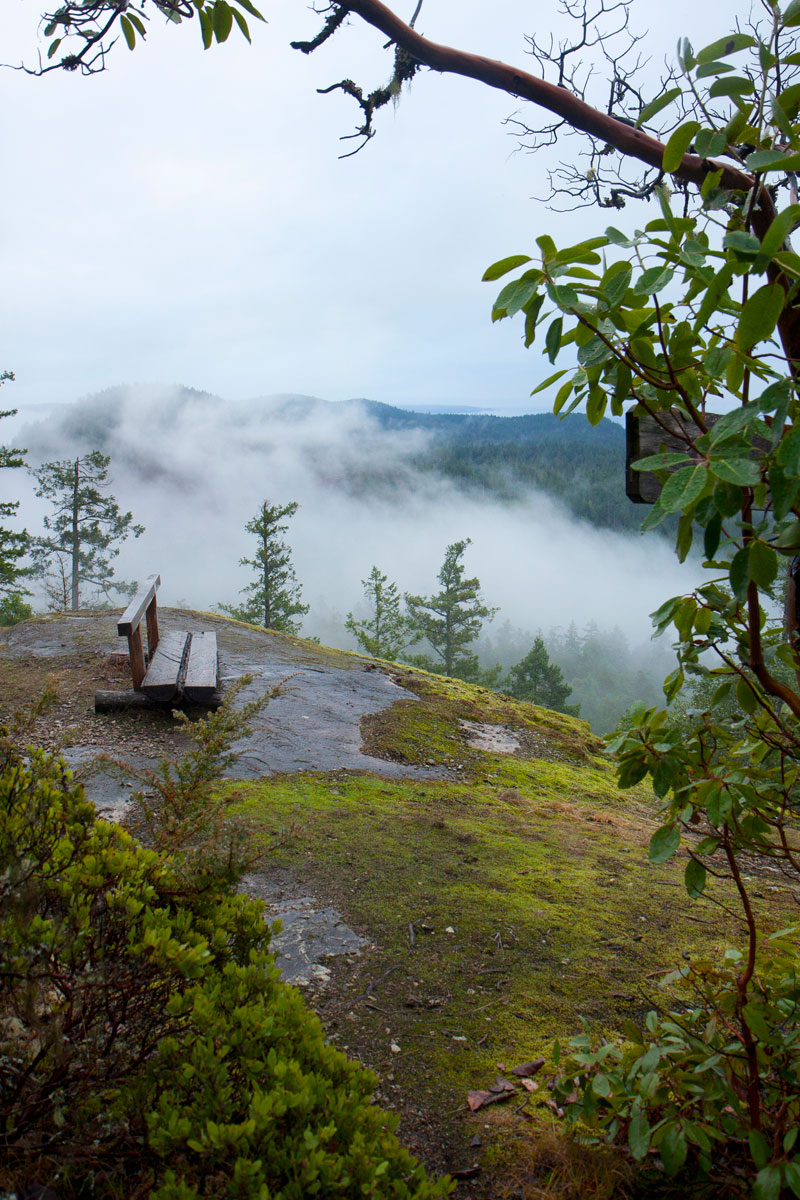
Manzanita Hut is located on Manzanita Bluffs on the Gwendoline Hills trail section. The main floor is a partially open shelter with two full walls protecting visitors from the wind that comes off the ocean on blustery days. There is a sleeping loft upstairs.
This is the third hut along the Sunshine Coast Trail when you are starting from Desolation Sound. It affords panoramic views of the Copeland Islands, Savary Island, and the Salish Sea. It is surrounded by manzanita bushes, arbutus trees, and old-growth Douglas fir trees. It is also a great place to spot eagles soaring in the air. One-and-a-half to two hours from either end of Gwendoline Hills Trail, it makes a great lunchtime destination for day hikers.
Manzanita Hut At-A-Glance
- 16
- 10
- Partially-open shelter
- Outhouses, picnic tables, fire pit, sleeping loft

The opening of the Manzanita Hut, pictured at the top of this page, saw 160 people in attendance. It was a real highlight in the life of the Sunshine Coast Trail, and an indication of how appreciative Powell Riverites are of all the volunteer work that gone into making the SCT and these huts possible.
How to get there
Drive out from Powell River toward Sarah Point as explained at the beginning of the Gwendoline Hills trail description in the SCT Guidebook. About 2.3 km past Lund, some 300 m beyond the last houses on Sarah Point Road, you will notice Rowe Road (Malaspina Forest Service Road 6106 Br.02) turning off on the right (N 49°59.822′, W 124°45.701′). Red metal markers have been attached to the telephone pole and a nearby wooden sign indicates SCT access.
It’s best to park here, unless you drive a 4×4. Follow FSR 6106 Br.02 southward, keeping an eye out for the occasional red metal markers as you pass a couple of old wood roads. 2 km in you will come to a triangle junction. Take the left fork and hike another km to Spire Trail (N 49°59.870′, W 124°44.444′), which you then must follow uphill to the right. You will come to SCT/Spire Junction (N 49°59.954′, W 124°44.084′) at the edge of a 2010 cutblock. Turn left, and hike 1 km up to Manzanita Hut (N 50°00.147′, W 124°44.382′).
See the Sunshine Coast Trail Guidebook for more detailed information.
