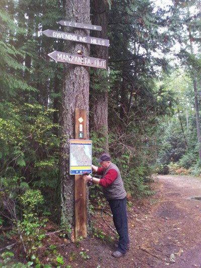
More of the new Map Signs are going up at various trailheads of sections of the Sunshine Coast Trail. The large majority of the thousands of hikers using the SCT annually do so making day-trips or an overnighter at one of the dozen free huts along the trail. They take advantage of the two dozen access points that lead to a variety of attractions from huts to lakes, water falls, beaches, old growth forests, mushrooms and mountain tops.
However, some do the 180-km-trek from Sarah Point to Saltery Bay all in one go. But even among the trekkers there is a variation with some not coming off the trail at all, perhaps even running it, while others get off it at main access points (Lund, Powell River, Mowat Bay, Lang Bay) to take advantage of the amenities that can be found in these centres of cultural delight.

PAWS is also improving the marking of the trail with new reflective metal markers that really work well even at night. We were able to acquire these markers through grants made by the Rotary Club of Powell River (Sunrise), and by the Powell River Community Foundation. Many thanks to these two organizations.